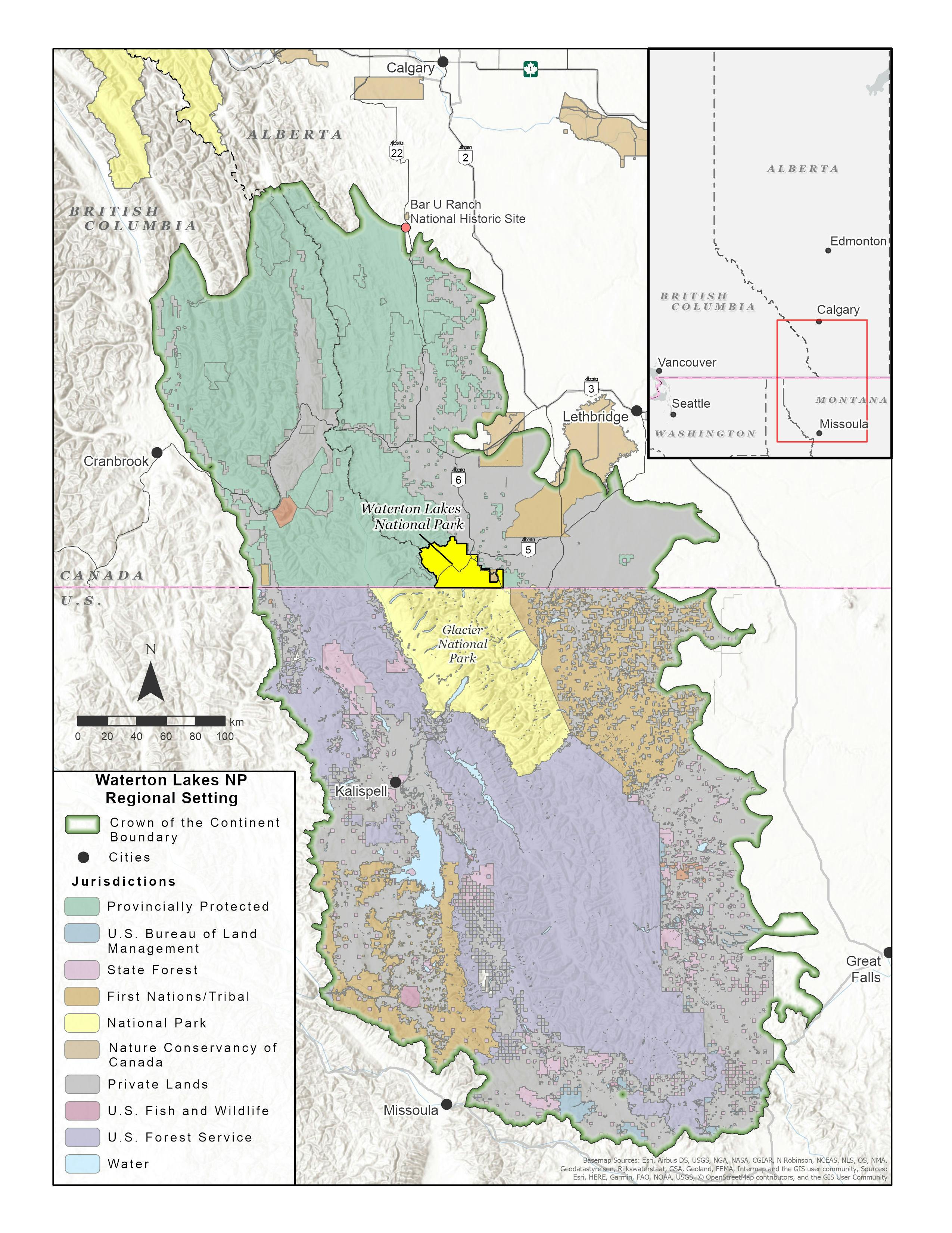
Maps

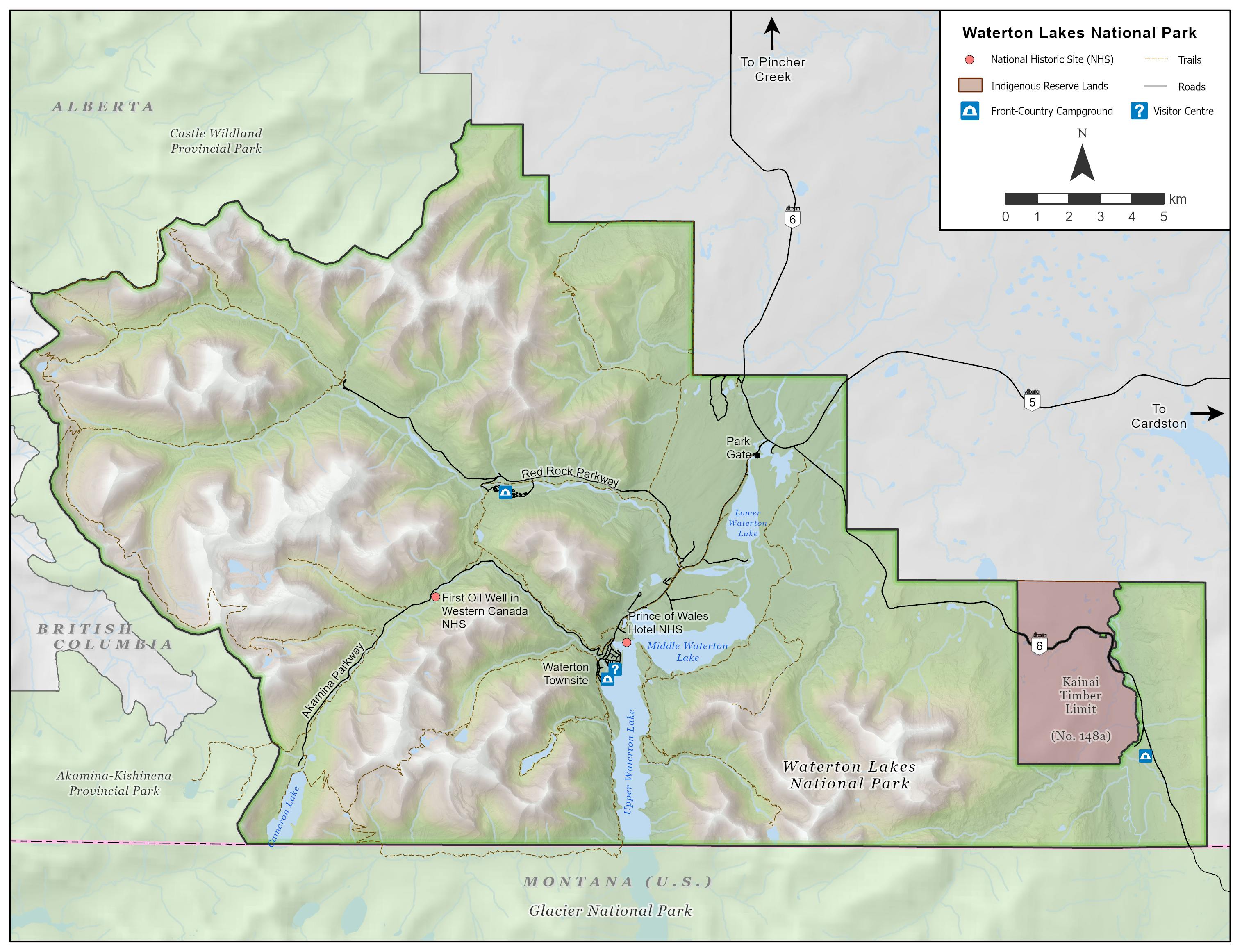
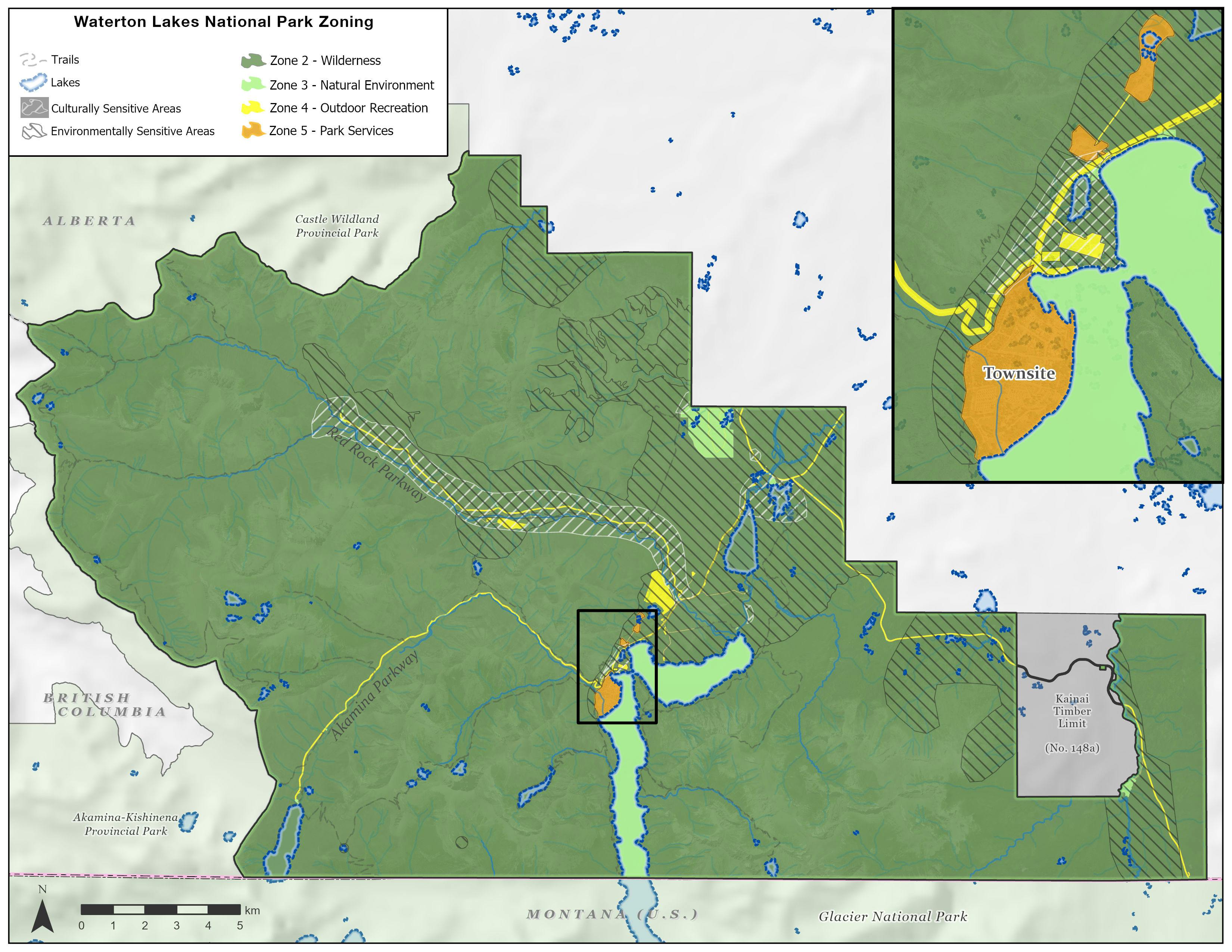
The Front Range Management Area consists of the northeastern and eastern portions of the park on the front ranges of the Rocky Mountains. This includes the north side of Cloudy Ridge, Mount Dungarvan, Mount Galwey, and Bellevue Hill, along with Horseshoe Basin and the eskerine grasslands in the north. In the eastern portion of the park, this management area includes everything east of Vimy Ridge and Sofa Creek. It encompasses 154 km2 or approximately 31% of the park.